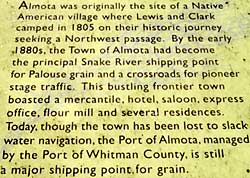
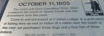
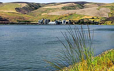
|
| It's
a longer drive to Almota than to the previous three sites along the
Snake River. WA HWY 193 curves inland at Wawawai headed toward Pullman
WA. After several miles of climbing through a canyon, it merges with
WA HWY 194. This highway winds over the hills, west, back down to
the Snake River at Almota ( See map at lct239a).
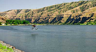
One interpretive sign is located at the marina parking lot. A paved
path leads from the boat launch, along the river, almost to Almota
Creek. An older sign, top right, is at the end of the path. Top left,
a plane practices takeoffs and landings on the river. The view is
east, toward the marina, from the path. Right, view west to Almota. |
|
|
|