|
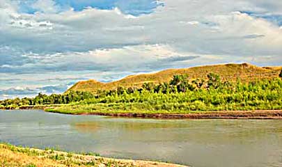
Marias River flows east, under I-15, top left, and continues toward
the Missouri, left. Lewis camped farther east on the Marias 7/18
after a 24mi trek. He was a few miles above his 1805, spot, see
lct64f. On the 19th they made 20mi along
the north Marias bank; 7/20's march ended 28mi later on the north
side of Marias, 5+/- mi southwest of Shelby MT. a bit west of I-15.
Top left photo is the approximate area of the river for the camp.
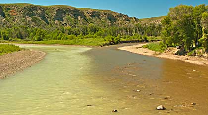
Top right, the Marias' source; Two Medicine River, left, Cut Bank
Creek on the right.
|