 |
 |
 |
 |
 |
 |
|
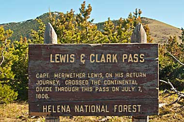
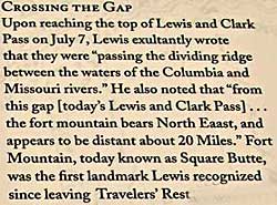
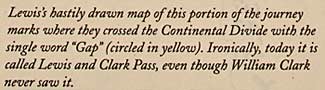
Lewis realized they were moving into the Missouri River watershed when he passed over the "Gap" and back into United States territory[based on the terms of the 1803 Louisiana Purchase] which included the Missouri River drain-age basin. Lewis planned to explore the northern boundaries of the area after he reached Great Falls. 7/7 camp; 3mi. east of Table Mountain. |
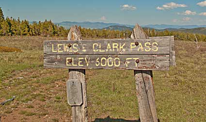
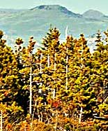
| Lewis wrote that he saw "fort mountain" 20 miles north east. The photo, top, shows it(?) between the elevation sign posts. A closer view shows it more clearly. Is that Fort Mountain? See page lrt16 for a closer view taken farther east. |
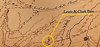
| Lewis Return Trail |
| lc main page |