 |
 |
 |
 |
 |
| Lewis & Clark Trail |
| Grand Bluffs Missouri |
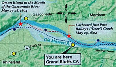
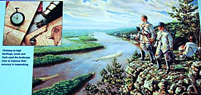
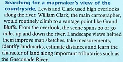
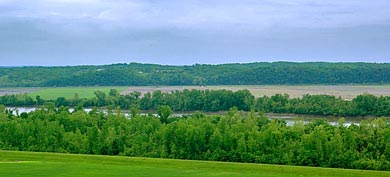
| These signs at the top of the bluff tell the story clearly. L&C used such high ground to view the lay of the land. One sign, above, lists and explains the use of navigational and mapping instruments. Left, a view of the Missouri from the "yellow dot" on the map, top left. The Corps camped across the river at the mouth of a creek (Deer Creek?) the night of May 29, 1804. |
| lc main page | maps |