|
|
| I
leave the Ft Mandan replica and continue down ND 17 in search of the
Ft Mandan Overlook. It's about 8 miles from the replica, mostly on
dirt road. I have to pay close attention because Hwy 17 doesn't go
straight there and there really are few direction signs ecxept the
highway number. Ascending and descending many hills and occasionally
turning left or right at crossroads, I finally arrive at - a cow pasture.
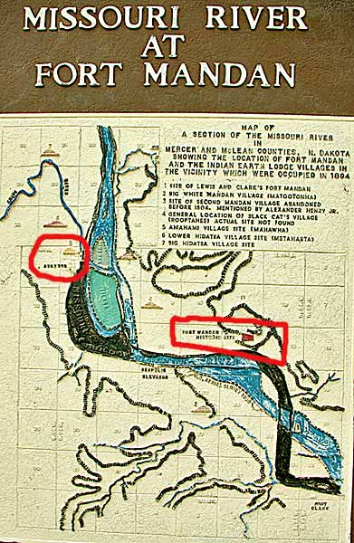
A cast iron interpretive sign stands on a hill about 100 yards into
the pasture. The red rectangle denotes the original Ft Mandan site,
now under water. The circle shows Sacagawea's village on Knife River.
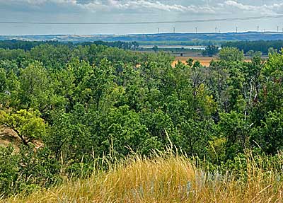
Above, a view of the area on the river thought to be the general area
of the original site. No Trespassing. |
|
|