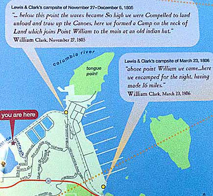
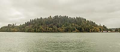
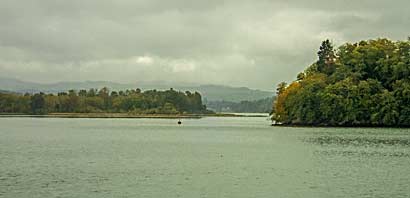
| The
map tells the story. The Corps used this area for two bivouacs; one
arriving and one leaving. The north face of Tongue Point, viewed from
the Portland Spirit excursion boat, top right, is close to the Corps'
view as they searched for a sheltered cove. They found it on the west
side of the point, far right, in the top right photo. The weather
was typically stormy. Later Clark noted the dire conditions: "below
this point the waves became So high we were Compelled to land unload
and traw up the Canoes, here we formed a Camp on the neck of Land
which joins Point William to the main at an old indian hut."
Right, the gap, left of Tongue Point, leads to the March 23, 1806
campsite-see lct356c. |
|
|