 |
 |
 |
 |
| Lewis & Clark Trail |
| Vancouver Washington |
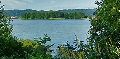
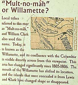
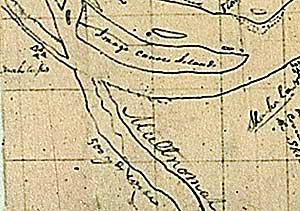
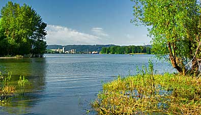
| Clark's map, above, shows the location of Image Canoe Island concealing the mouth of the Willamette as the Corps passed on the north side. Top left, Sauvie Island, south across the Columbia. Right, The Willamette River (buildings) enters the Columbia from the south. Photos from Frenchman's Bar Park, west of Vancouver.The interpretive sign is there too. |
| lc main page | maps |