|
| As
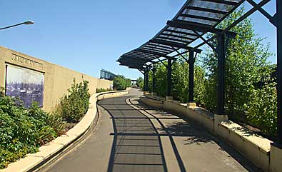
visitors pass through the Welcome Gate (see previous page) they enter
the Timeline Path, top right. The wall images (left side of photo)
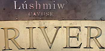
depict land use in the area over time. Top left, the Language part
of the Confluence Project displays Native American words associated
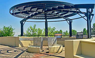
with local surroundings. Three overlooks explain the history and geography
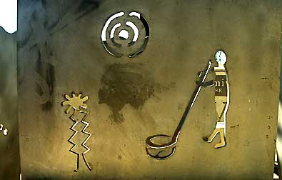
of that particular view, above. Aboriginal rock art designs, right,
are cut into brushed metal sheets at the center of each overlook alcove.
Plants native to Oregon and Washington line the path. |
|
|
|