|
|
|
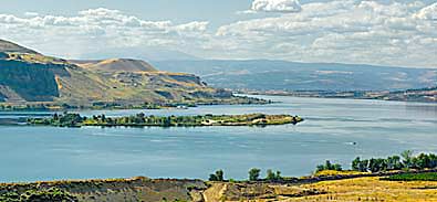
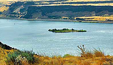
Islands in the Columbia River aren't obstacles to river traffic now.
These views are from Wishram Overlook on WA HWY 14. The southeast
view, left, and southwest view, above, show a much wider river since
the Dalles Dam halted the Columbia's natural flow in 1957, creating
Lake Celilo. Celilo Falls was a great trade junction, centered on
abundant dried salmon processed by local tribes. Indians arrived from
the Rocky Mountains and the Pacific Coast to trade their goods for
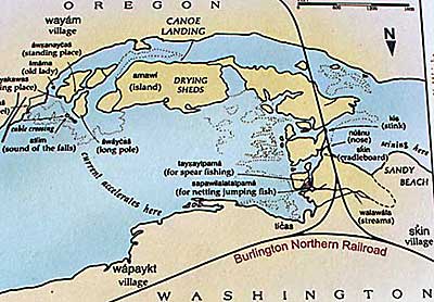
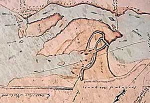
dried salmon (see previous pages). A portion of Clark's map, above,
can be compared to a 1930 version, top left. The islands in the photos
are not in the area depicted on the maps. |
|