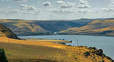
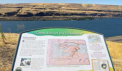
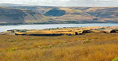
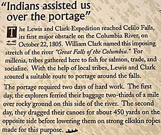
| The
Wishram Overlook, on WA HWY 14, has an interpretive sign describing
what used to be seen from this spot: Celilo Falls. The Corps needed
two days to negotiate this obstacle. Top left, the Deschutes River,
on the Oregon side, meets the Columbia (center, in the photo). The
other two photos show where the "Great Falls" thundered
down until 1957 when the Dalles Dam backed up the river. The Corps
camped below a Wishram village going west. On the return journey,
they camped in a village across from the Deschutes River. |
|
|
|