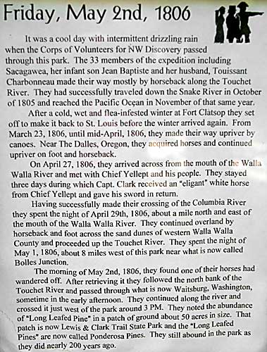
|
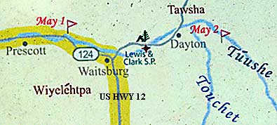
Lewis and Clark Trail State Park is five miles west of Dayton on
US HWY 12. The Corps passed here during the day on May 2, 1806.
They bivouacked that night a few miles west of Dayton (See previous
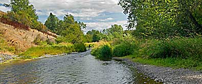
pages).The Touchet River flows west, above. The sign, left, tells
the story of the Expedition's overland journey east over the "Forgotten
Trail." The Lewis and Clark Trail State Park is divided by
US HWY 12. The north side has the campground and a trail along the
Touchet River. The south side has the picnic grounds and the majority
of the Lewis and Clark Trail signs in a kiosk near the restrooms.
If you want to catch some of the lower Snake River Lewis and Clark
campsites, you could take WA HWY 124 west at Waitsburg.
|