|
| The
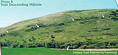
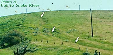
two bottom photos (mine) match the top photos from the interpretive
sign at the 3 Forks Indian Trail Turnout. Refer to the map on the
previous page for geographic orientation (north-south). Photo B shows
the trail the Corps descended as they moved east from the Columbia
River. Photo A follows the trail north up the ridge toward the Snake
River. Lewis and Clark, on the suggestion of local natives, chose
to travel by horse from the Columbia River at Walula to Chief Twisted
Hair's camp where they had left their original horses, saddles, and
other gear not needed on the westward journey. The 3 Forks Indian
Trail is a segment of an ancient Indian path from the Columbia River
to the Snake River. The entire trail is now referred to as "The
Forgotten Trail." A detour off US HWY 12 takes you to the Corps's
lunch spot on the Tucannon River (see next page) before continuing
on The Forgotten Trail or heading back to the Snake River for more
1805 LCT sites. |
|
|
|