|
| The
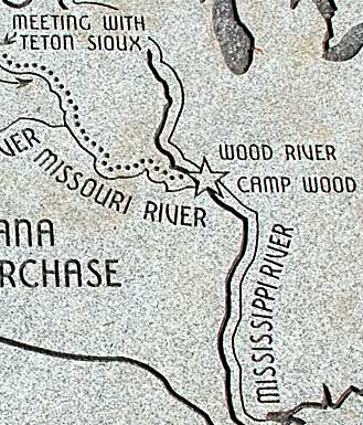
map, bottom right, illustrates the major changes of the river courses
involved in the LC expedition. Wood/DuBois River moved north a few
miles, while the Missouri gravitated south moving even farther away
from their original face to face locations. Wandering river beds constantly
plague experts trying to pinpoint LC sites. A granite slab etched
with a map of the journey lies at the entrance of a second fort replica
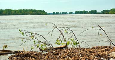
in the town of Wood River IL (see next page). Top right, view of the
Mississippi/Missouri confluence from the Illinois side north of the
L&C Interpretive Center. |
|
|