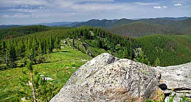
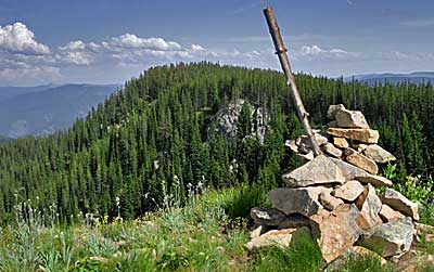
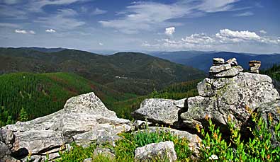
| Smoking
Place is close enough to FR 500 for visitors to ascend a short trail
to this ridge (see next page). Clockwise from bottom left: Guide Bob
Clark surveys the route east that the Corps navigated in 1806; the
ridgeline curving east to the southeast; rock cairn, smaller, but
similar to the one both Lewis and Clark described; the view south
that the captains mentioned in their journals. Local LCT expert Steve
Russell comments on the cairn: "[It] has never been reported
in journals of later travelers...." He saw no cairn until the
1990's. |
|
|
|