|
|
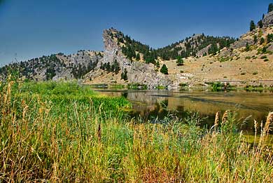
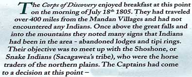
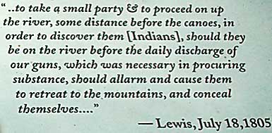
| The
signs explain the significance of Spite Hill Fishing Access to the
Lewis and Clark lore. The sign, top left, describes the evidence of
Indian presence in the area; bark peeled from pine trees, brush huts,
and teepee rings. Sacajawea assured the Captains that these were Shoshone
doings - her people. Captain Clark drew the duty to walk ahead and,
hopefully, meet Shoshone hunters. He took John Potts, Joseph Field,
and his slave, York. They would camp with the main party only once,
July 22nd, before meeting again at the Missouri Headwaters on July
27th, 1805. Spite Hill Fishing Access is a few miles south of Mid
Canon or a few more miles north of Craig, on the Missouri Recreation
Road. I-15, Exit 240 or 234. |
|
|
|
|