|
| Franklin
Island Conservation Area is west of Rocheport off US HWY 40. The Corps
camped here at the mouth of Bonne Femme Creek on July 7, 1804. The
creek runs along the eastern edge of the conservation area. Corpsman
Patrick Gass summed up the journey of the past two days: "On
the 6th, we passed Saline creek on the south side; and on the 7th
the river of the Big Devil[ Moniteau Creek] on the north; and Big
Goodwoman's[Bonne Femme] creek on the same side, where we camped."
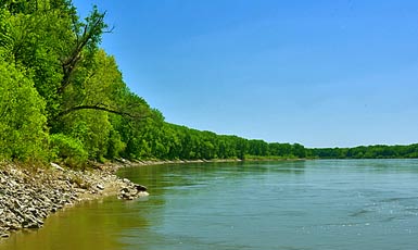
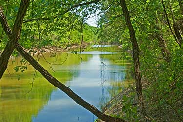
Right, Bonne Femme Creek on its way to the Missouri. I followed it
through heavy brush trying to get to the mouth. This is the best I
could do - probably two - three miles from the confluence with the
Missouri River. Above, the Missouri flows downstream past the mouth
of Bonne Femme Creek somewhere out of sight. The Missouri used to
have a channel north of here making this area an island; hence the
name Franklin Island Conservation Area. |
|
|