|
|
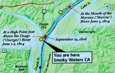
Smoky Waters Conservation Area contains a section of the Osage River
close to its old confluence with the Missouri. This is what Clark
was looking at from the hill (see previous page). It's also the area
of the June 1-2 and Sept 19, 1806 return camp. The Osage River has
changed course and enters the Missouri several miles down river -
east of this spot.
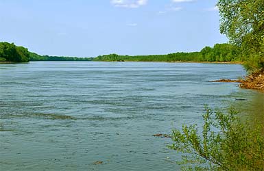
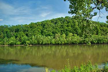
At the June 1-2 camp the captains took astronomical observations and
measured the width of the Missouri and Osage Rivers. Missouri: 875
yards wide; Osage 397 yards wide. These photos of the Osage, left,
and the Missouri, above appear to be at about the same widths as recorded
in 1804. Clark reported in his June 1 journal entry that they "...
fell a number of Trees in the Point [ where Osage and Missouri Rivers
met in 1804] to take observations." Floyd and Whitehouse mention
the foliage clearing also. |
|
|