|
|
|
| On
May 23rd Lewis continued walking on shore while the boats moved up
the river. They visited Tavern Cave - a famous traveler stopping place.
Clark carved his name on a wall here. Lewis almost fell from the bluff
above the cave, saving himself with his knife. I couldn't find any
information on it or locate it on a map. A visit to Petersville and
St. Albens, on the other side of the river, might turn up more information
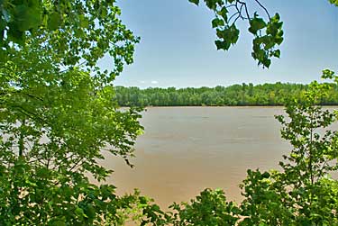
- I chose to stay the course on the north side. I drove on to Klondike,
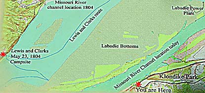
the nearest town to the May 23rd camp. As you can see by the map their
camp would have been some miles beyond the tree lined south shore,
above. The shifting river channel, see map, top left, now places many
camp sites on farms or ranches many miles from the present river.
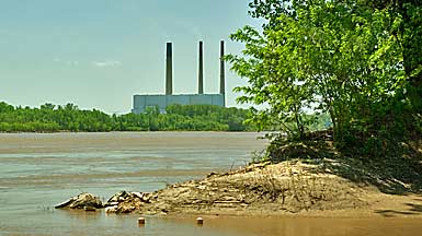
The power plant in the photo is located in the top right corner of
the map. |
|
|