|
| The
state park is accessed from I-84, in Troutdale, at exit 18. Road signs
to the parking lot are easy to follow. Interpretive signs, above and
next page, explain the Corps's activities here on the outbound and
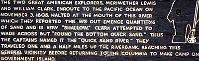
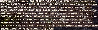
inbound journeys. Captain Clark hiked 3 miles from Rooster Rock to
the mouth of the Sandy River. Private Whitehouse commented; "abt.
noon we halted to dine at the mo. of a River...on the Lard. Side,
the mouth of which was filled with quick Sand So that we could run
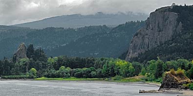
a pole 6 or 8 feet in it...." Top left photo: looking east on
the road to Sandy River. The Columbia River flows past Rooster Rock,at
left in the photo, and Crown Point with Vista House at the right.
Clark hiked through the area on his way to Sandy River. Left photo:
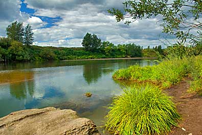
Sandy River in the vicinity where the Captains explored. |
|