|
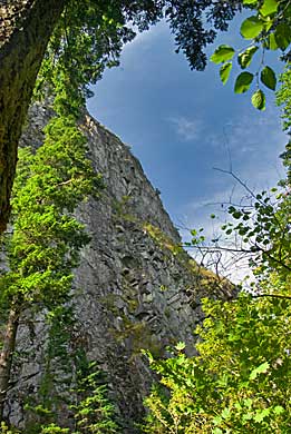
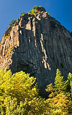
| Captain
Clark had these views of Beacon Rock as he walked the Columbia's north
side, studying the Cascades of the Columbia. The Corps needed to negotiate
this last stretch of turbulent water on the river. Clark had to hike
around the base of the monolith to estimate its circumference at "400
paces around." He would have looked up at these massive walls
(above and far right) as he and Joseph Fields counted. |
|
|
|
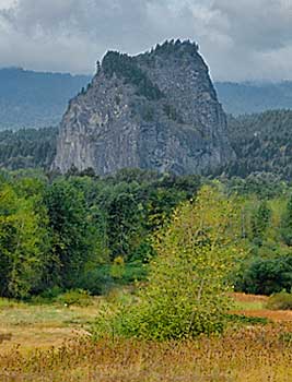
| Prior
to their pacing the base, Captain Clark and Joseph Fields approached
Beacon Rock from the east by way of Strawberry Island (named by Clark
for the strawberries growing there), center. Clark estimated the rock
at "about 800 feet high." This was within 48 feet of its
actual height of 848 feet. The rough, weathered face, above, may have
led Clark to first name it "Beaten Rock" (See previous page). |
|
|