|
| Although
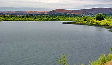
Captain Clark's excursion didn't get this far, there's a great view
of the Yakama River estuary, above. These views are looking south
from Columbia Point Marina Park, just north of the I-182 and US HWY
12 crossing of the Columbia River. The best views are from a dirt
trail which passes, south, under the highway bridge. The Yakama River
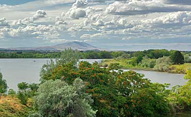
enters the Columbia from the right. Right, looking north towards Columbia
Point Marina Park from Columbia Park. Bateman Island is in the foreground
(see maps on the next page). Clark stayed at an Indian village south
of Bateman Island, on the east side of the Columbia. You can access
Columbia Point Marina Park from I-182, just west of the Columbia River
bridge. |
|
|
|