 |
 |
 |
 |
| Lewis & Clark Trail |
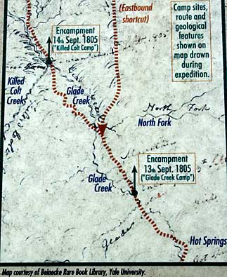
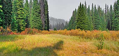
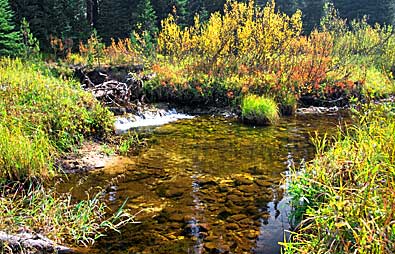
| The map is part of the overlook sign. It points west from Lolo Hot Springs to Colt Killed Creek. The top photo shows the meadow east from the Glade Creek Camp area. Pack Creek, named Glade Creek by Lewis and Clark, above, flows west from the general area of their September 13, 1804 campsite. Some of the images were recorded in September 2007. Others were done in September 20012. The pristine quality has been maintained. Let's hope it continues to stay this way. |
| Lolo Pass - Montana/Idaho |
| lc main page | maps |