|
|
| US
HWY 93 drops down from Lost Trail Pass to Sula. This highway traverses
western Montana through Hamilton, Missoula, Kalispell, and Whitefish,
to the Canadian border. I'll take it only as far as Lolo, where the
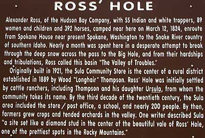
Lewis and Clark Trail turns west. An interpretive sign, top left,
explains Ross' Hole but no mention of Lewis and Clark. The Corps,
hungry and cold, thrashed down the north side of the pass, crossed
Camp Creek, and encountered a new Native American tribe. Clark calmly
recorded this surprising event: " prosued our Course down the
Creek ... where we met a part of the <Flat head> nation of 33
Lodges about 80 men 400 Total and at least 500 horses, those people
recved us friendly...." Their language was unknown to the Captains.
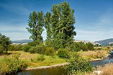
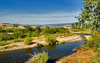
Left and above, Camp Creek flows north along US 93 and joins the East
Fork Bitteroot River in Sula. I can imagine the scene here in September
1805; tepees standing along the river and Salish (Flathead) men, women,
and children, mingling with the Expedition. |
|