|
|
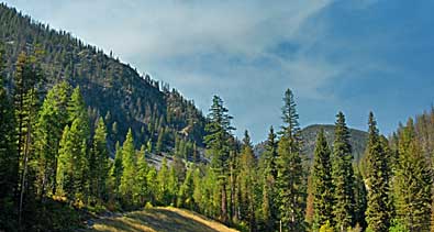
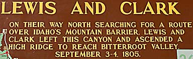
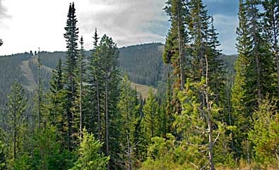
| The
interpretive sign picks up the Corps's story from the Deer Creek camp
to their introduction to the unforgiving Bitterroot Range. The Indian
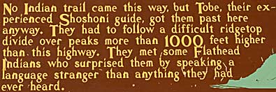
trail they had been following turned east. Old Toby, the Shoshone
guide, led them straight north - through brush, thick forests and
steep valleys and peaks. Clark reported that they had rain, sleet
and snow to make the journey more difficult. Private Joseph Whitehouse
commented: " Set on to raining hard at dark So we lay down and
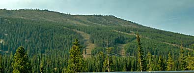
Slept, wet hungry and cold." Top right, starting up the pass
from the south. Left and right, Lost Trail Pass Rec. area. The Corps
followed these ridge lines. Us Hwy 93 winds up to the pass. |
|
|