|
| The
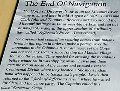
interpretive sign summarizes the Lewis and Clark story to this point.
Reading this sign, a person, without much knowledge about the journey,
could easily understand the significance of this area to the Corps's
continued success. I particularly like the depiction of "the
forks of Jefferson's river"(Lewis), left. Lewis, Drouillard,
and Shields spent some time on August 10th determining which branch
to follow - reminiscent of earlier river junctions. This time they
had Indian trails as clues. Lewis analyzed one trail to select the
southwest route, up Horse Prairie Creek. They would return to the
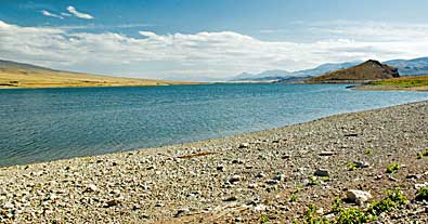
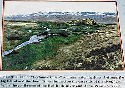
forks on August 16th with a contingent of Shoshone. Top left, the
scene today. Armstead Island, back right, is the only point of reference
left. I would guess their camp would have been right in the middle
of the reservoir in this photo. |
|
|
|