 |
 |
 |
 |
| Lewis & Clark Trail |
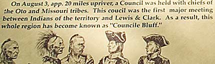
| Council Bluffs Iowa |
|
The top left image looks north up the Missouri from the Lewis and Clark Monument. Center left is a view southwest of the river with Omaha NB in the background. Referring to the map, a shore party of hunters came in contact with three Indians dressing an elk. The meeting happened somewhere between the monument and the July 28 campsite. The contact led to the later council. |
| lc main page | maps |