|
| From
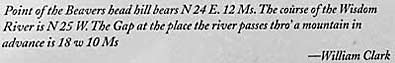
the top of "...a high Point of Limestone rocks..." Clark
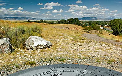
recorded a compass bearing for "... the Point of the Beaver head
hill..." as N. 24 degrees E. 12 minutes, top right. He also recorded
compass points for other landmarks the Corps had passed by already:
The "Wisdom" or Big Hole River to the northwest, right;
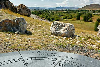
and features his crews had not seen yet; The Rattlesnake Cliffs to
the southwest, above. Lewis had already passed, and named the cliffs
on the 10th, as he moved ahead of the main party, searching for the
Shoshone. It's a privilege to use Clark's "large" compass
to to identify some of these geographic features yourself. August
13, 1805; as Clark climbed to the top of this limestone bluff to take
compass readings, Captain Lewis, John Shields, Hugh McNeal, and George
Drouillard were meeting the Shoshones west of Lemhi Pass. |
|
|