|
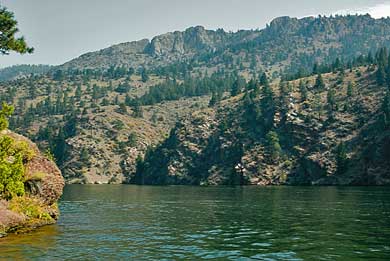
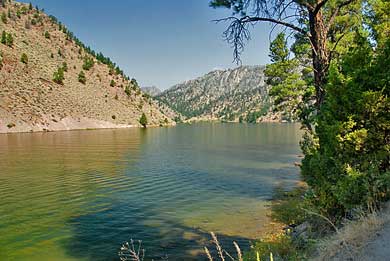
Captain Lewis, with the canoes, on the Missouri River, pulled into
a camp on the right side of the river, somewhere around the bend
in the river, in the top right photo. The photo, above, looks down
river from the west end of York Bridge (see previous page). The
top right photo looks down river, around the bend, from the east
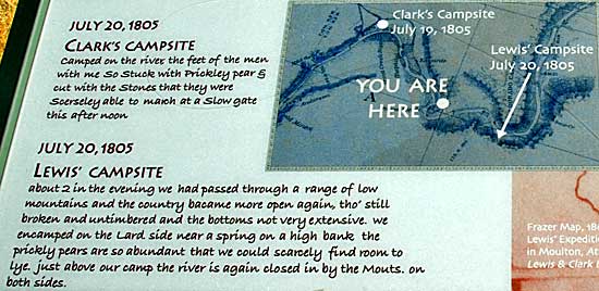
end of the bridge. The sign, right, explains the "Two Camps"
as well as journal entries from the Captains. While Lewis camped
north of the area shown above, on the 20th, Clark camped at White
Earth Creek, up river. Both parties observed smoke from fires set
by Shoshone hunters, fearing enemies in the area.
|