|
|
|
|
|
|
|
|
|
|
|
|
|
|
|
|
|
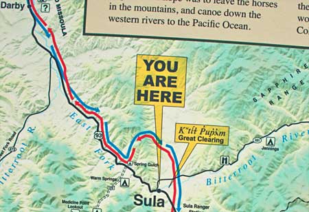
| Below:
East Bitteroot north of Sula lft. Clark's trail over to Sula area
rt. |
|
|
|
|
|
|
|
|
|
|
|
|
|
|
|
|
|
|
|
|
|
|
|
|
|
|
|
|
|
|
|
|
|
|
|
|
|
|
|
|
|
|
|
|
|
|
|
|
|
|
|
|
|
|
|
|
|
|
|
|
|
|
|
|
|
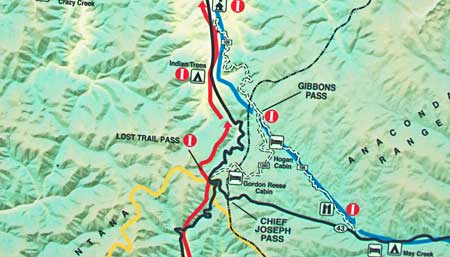
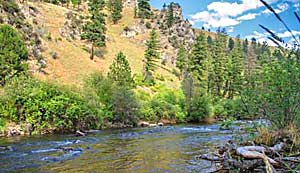
| July
3, 1806: Captain Lewis and Captain Clark left Travelers' Rest on separate
explorations. Lewis headed north down the Bitteroot River; Clark moved
south up the Bitteroot. Both went by horse and foot. The river was
a geographic route guide at this of their journeys. Clark's route
led him along the Bitterroot, above, a few miles north of Hamilton
MT. Where he camped. |
|
|
|
|
|
|
|
|
|
|
|
|
|
|
|
|
| July
4, Clark's party celebrated the day with a "fat Saddle of Venison"
then slogged through deep flowing side creeks to the East & West
Bitteroot confluence to form Bitteroot River.They camped here, 5mi.
north of the '05 camp at present Sula. They camped at Sula again on
7/5/06. US 93 follows the 7/3-5 trail. |
|
|
|
|
|
|
|
|
|
|
|
|
|
|
|
|
|
|
|
|
|
|
|
|
|
|
|
|
|
|
|
|
|