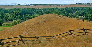
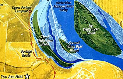
| Top
left, the Upper Portage Camp was by the Missouri River, along the
tree line. This photo is from the overview site (see previous page).
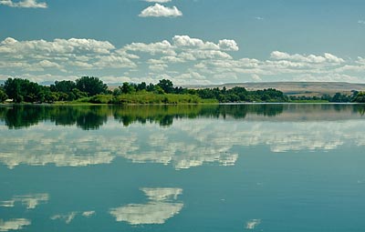
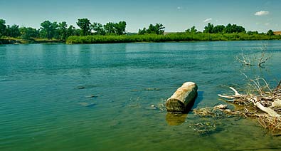
The Missouri River photos, with one of the White Bear Islands, give
a clue to what the camp area might have looked like. The sign shows
that the river was much closer than it is now. River Drive South turns
into Lower River Road along this stretch of the Missouri River. Residences
and business along the river leave few opportunities to get close
to the Missouri near the Upper Portage Campsite. |
|
|