|
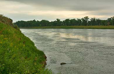
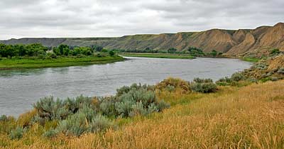
Following the road less than a mile beyond Decision Point brings
you to the Missouri River again. Top left, the Missouri flowing
east toward the Marias River, around the bend. Above, looking west
toward Fort Benton. Captain Clark led his exploratory group along
the ridge on the right bank. He wrote:
"... our first Course was S. 25[degrees] W. 7 miles to the
S. fork [the Missouri] at a Spring, at which place the little river
[the Teton] which falls into the N fork [the Marias] is 100 yards
distant only Seperated from the South fork by a narrow ridge."
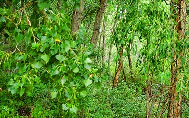
Captain Lewis started noting the narrow leaf cottonwood tree
soon after moving up river from Decision Point. At left, are examples
of broad leaf and narrow leaf cottonwood trees at
Decision Point. Lewis mentions later that he was seeing more
of the latter and few of the former as they moved up river.
|