 |
 |
 |
| Click here to view full sign. |
 |
| Dillon |
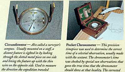
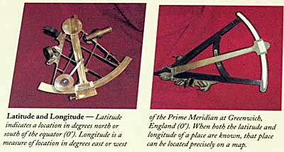
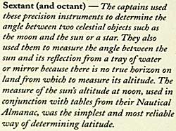
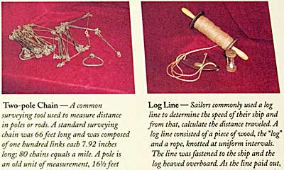
| This interpretive sign goes into great detail explaining each navigational instrument carried by the Corps of Discovery. The Captains recorded their location at certain times with fairly accurate degrees of longitude and latitude. They also were able to measure distance traveled, including the distance in miles from that point back to Ft. Wood/DuBois. |
| Lewis & Clark Trail Montana |
| lc main page | maps |