|
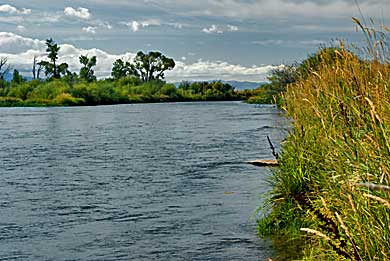
| Captain
Lewis and a small number of crew members hiked overland, searching
for Shoshones, while Captain Clark guided the canoes up the Jefferson
River. On August 4th, Lewis discovered two major river branches; the
Ruby/"Philanthropy" River, and the Big Hole/ "Wisdom"
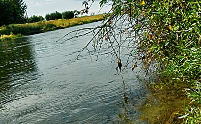
River. See the previous page for photos of these rivers. After a reconnaissance,
Lewis determined that neither was the main Jefferson River. There
was another branch heading straight south. The Big Hole branch was
tempting because it derived from the southwest - close to the direction
they intended to travel. Lewis explored 15 miles up the Big Hole before
he made a decision. Clark arrived on the 5th and chose the Big Hole
as the main channel. Ten miles upriver he met Drouillard, from Lewis's
party. Drouillard informed Clark that Lewis had determined the Beaverhead
River was the continuation of the Jefferson River. Beaverhead River
(top photos) is the modern name for the Jefferson beyond Twin Bridges.
Lewis and Clark called the area the"Forks of the Jefferson."
Left, on MT HWY 41 south of Twin Bridges. |
|
|